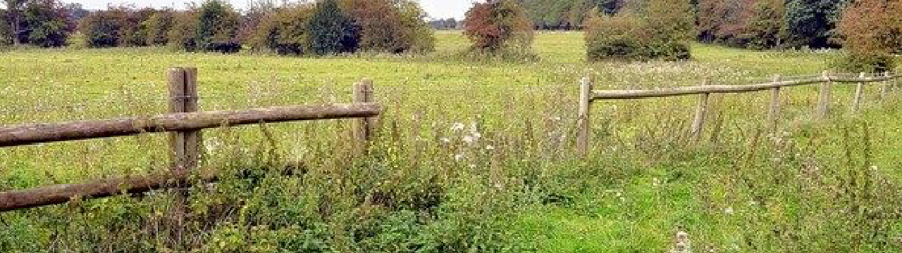
Floods in the Meadow are a way of life.
Thinking of buying a Barratt Home on this development? I’d think again.
Barratt Homes have at least been consistent with their contempt for the people of Stoke-on-Trent, Council Officers and the planning process. But to skirt over flooding risk and to plan to build homes in an area prone to flooding is astounding and dangerous. Will unsuspecting new home owners be able to get insurance? Who will pay to clean up the mess when the Newstead brook bursts its banks again because the culvert can’t cope? What about the safety of children around a flooded and fast flowing Newstead Brook?
Updated 1/3/2015
A little research by residents has uncovered further evidence of flooding and how the flood risk around Newstead Brook is set to get worse. Also in Barratt Homes “Flood Risk Assessment” there appears to no mention of the approved surface water drainage plans for the Stanley Matthews Way development.
All Surface Water drainage from circa 300 houses on the approved Stanley Matthews Way development will be routed into the Newstead Brook. Detailed plans available for the first phase of development indicate that the run-off rate could be as high as 390 litres per second during a flood event. In contrast to the model used by Barratt Homes to justify their view of flood management, the reality in the meadow is somewhat different.
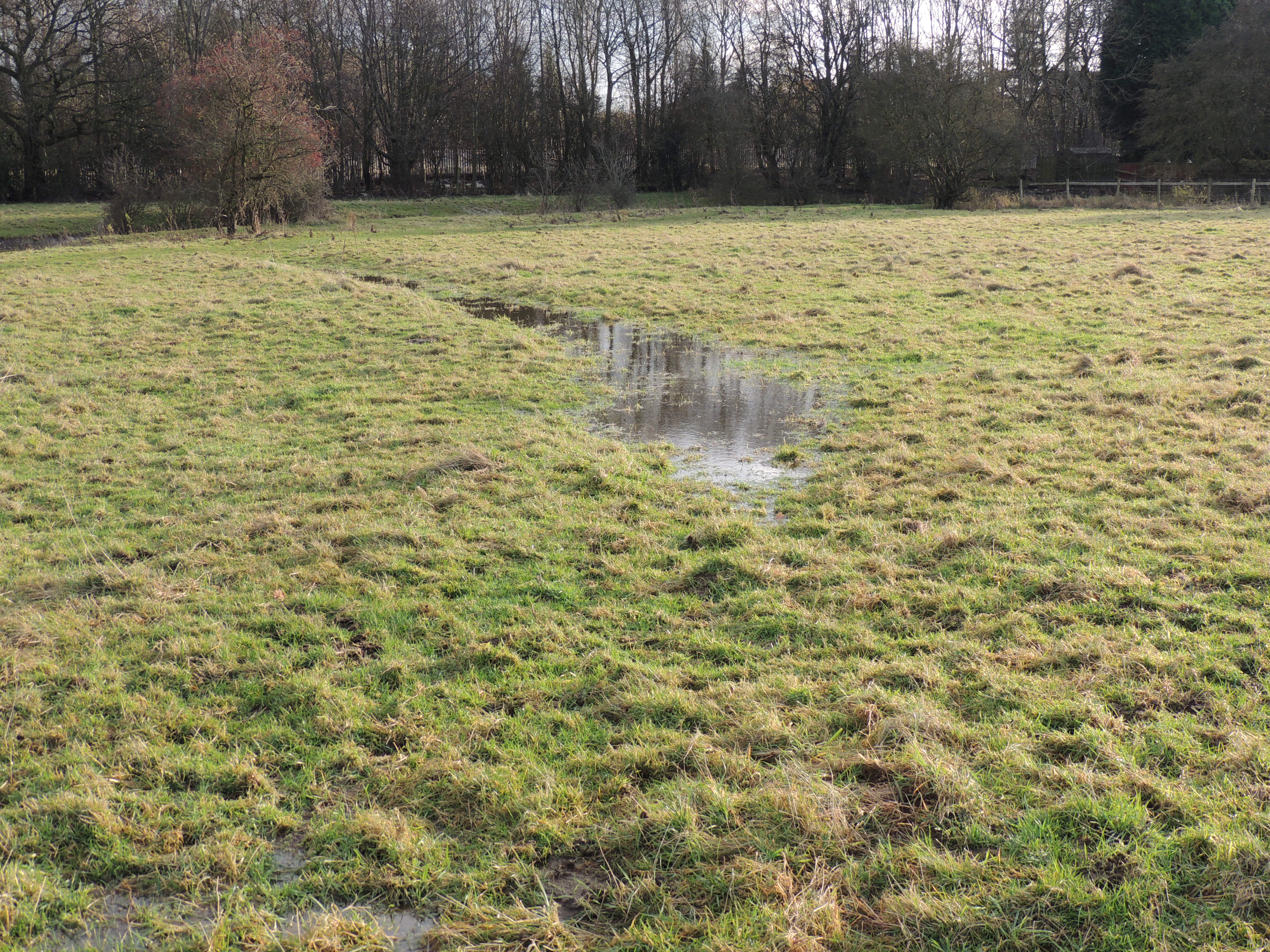
Even without a culvert blockage, flooding in the meadow is common due to the capacity of the culvert and the inability of the ground to soak away surface water. I’m no expert, but I think it’s safe to say that the additional surface water run-off from Stanley Matthews Way into the Newstead Brook is likely to make floods occur more often and to be more severe. With an estimated depth during a flood on the downstream side of the bridge at around 2m and a fast flowing sub-surface current, it just can’t be safe in the centre of a residential area can it?
Below: 2012 Newstead Brook flood receding. With the culvert overwhelmed, the Brook rose to a high of 0.5m above the level of the bridge. Yes, this is a photo of the bridge, and you can see clearly that the water level rose up the base of the tree and over the riverbank to flood adjacent parts of the meadow.

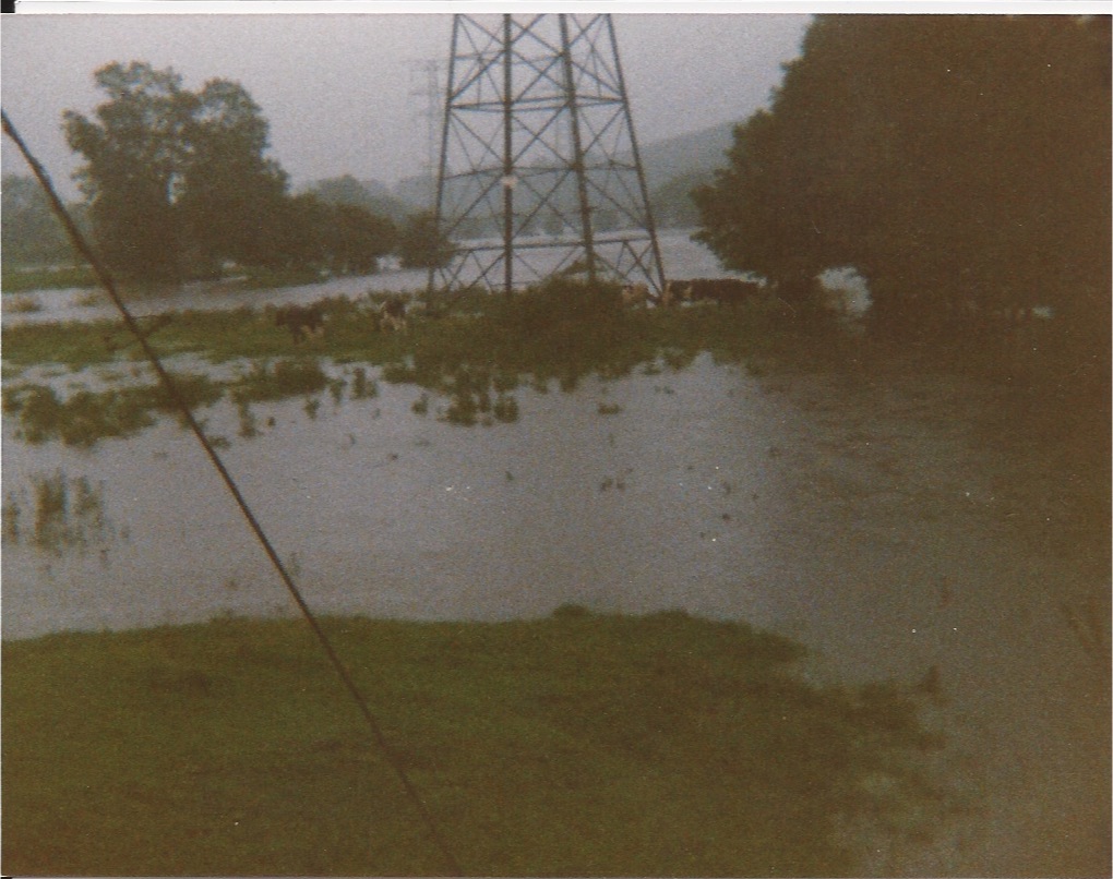
Below: 2009 stranded cattle. Anyone for a swim? Readers may notice cattle stranded on an island under the pylon in the middle of the meadow.

Barratt’s claim of low risk surface flooding (white)

Actual surface flooding in orange. (see photo above)
.
.
.Spot the difference?
.
Above: Actual surface flooding.
Left: Barratt claim its a low risk area.
Right: Area of surface flooding in above photo.
Hmm, who to believe? Barratt Homes or the actual evidence? doesn’t look low risk to me. Why would anyone risk buying a house here?
Updated 4/3/2015
To the north of the site, Barratt Homes plan to build on low lying land in close proximity to the Longton Brook. Whilst this brook has considerably less water flowing through it than flows through Newstead, I imagine it will make a mess of nearby homes when if floods. The developers say its low risk, and houses are a “considerable” distance away. The nearest planned houses are actually quite close and on paper the flood risk might look low, however, rather inconveniently ( for the developers ), the risk of flooding is considerably higher due to the culvert blocking.
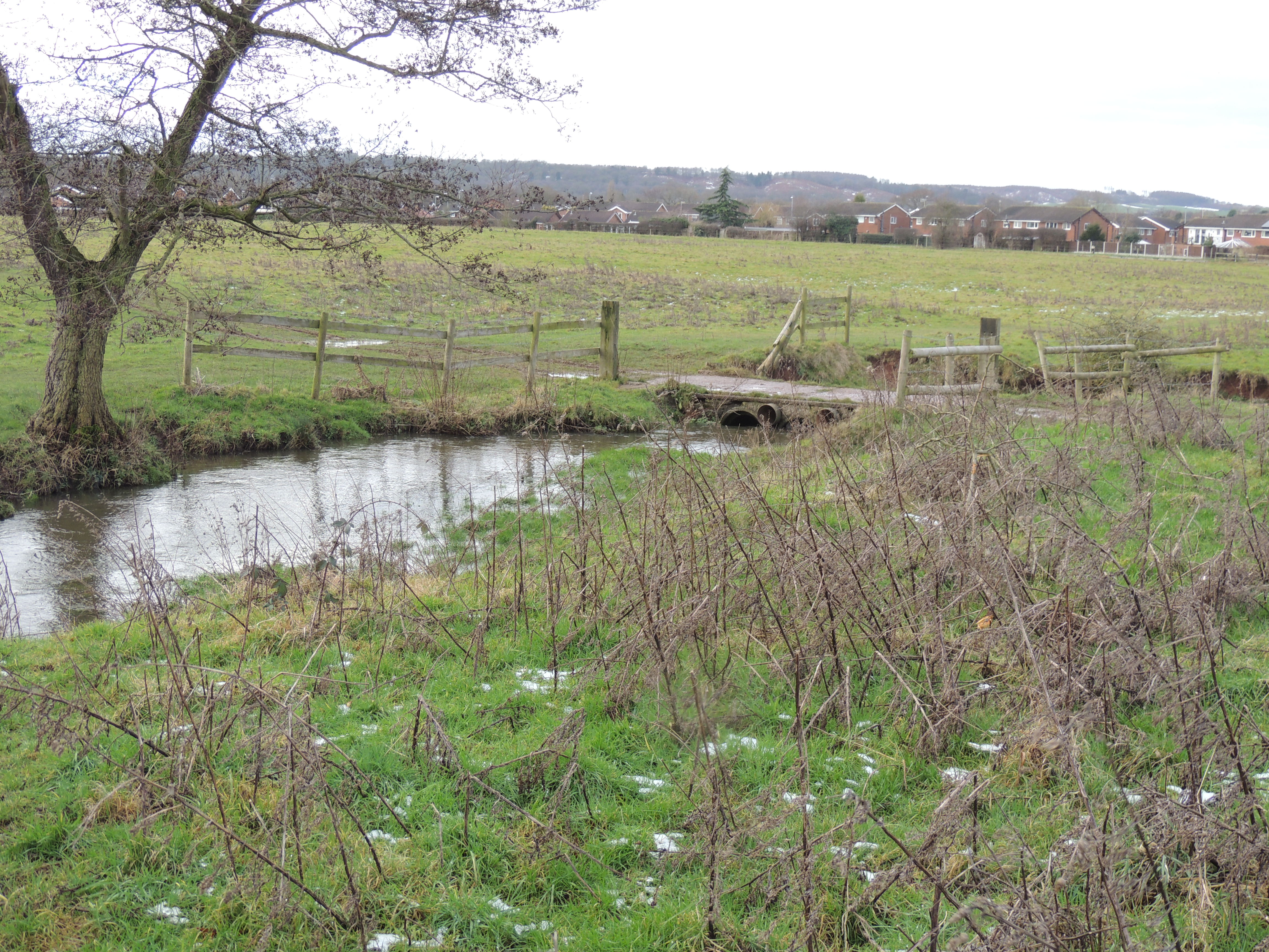
Below: 2015 photo of the culvert in its normal state.

I’d imagine a responsible “caring” developer would volunteer this information and put forward a plan to prevent any future blockages, but that would reduce profits!
Sadly, but rather predictably, there appears to be no mention of this issue in Barratt’s 2015 flood risk report.
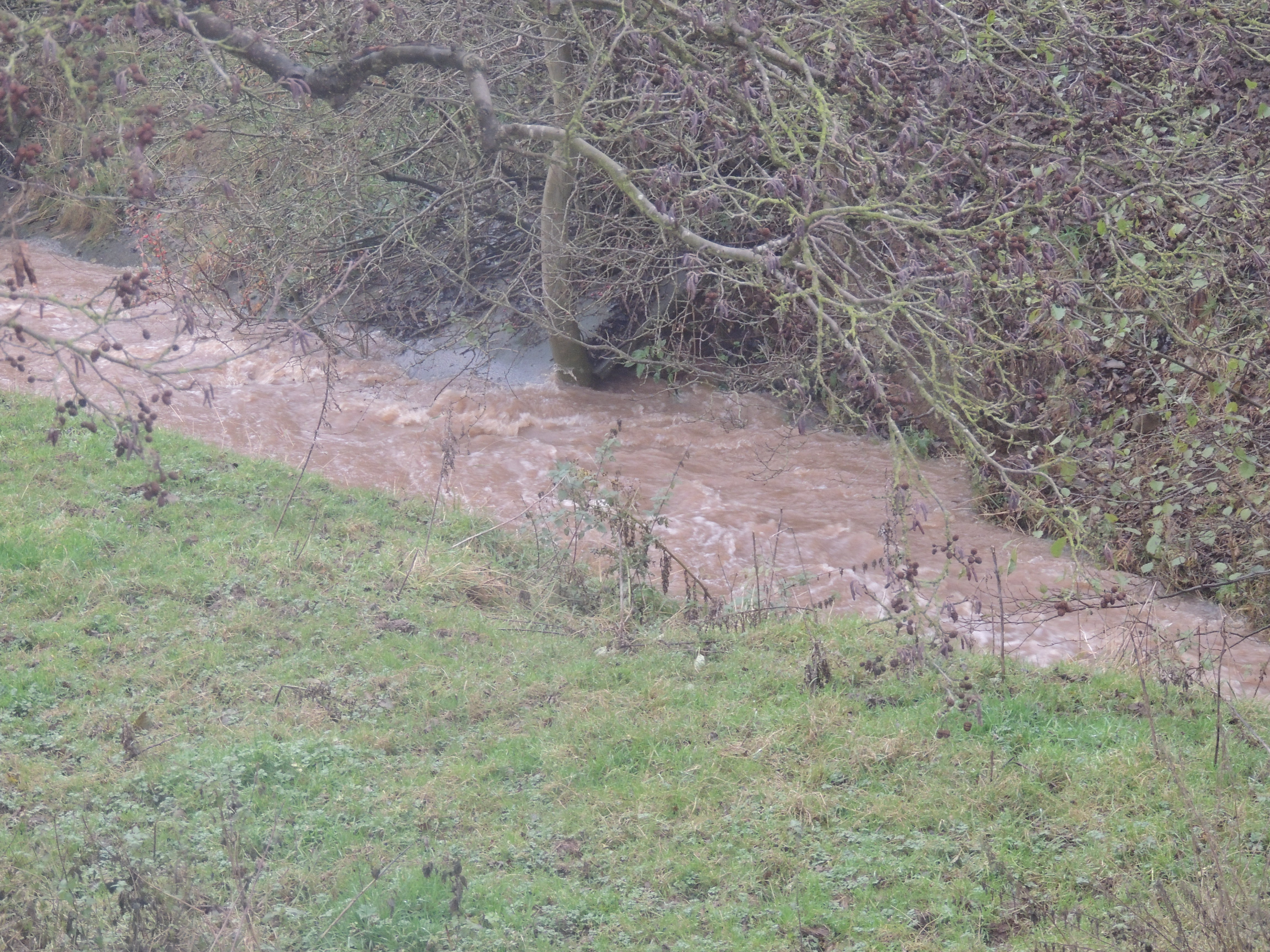
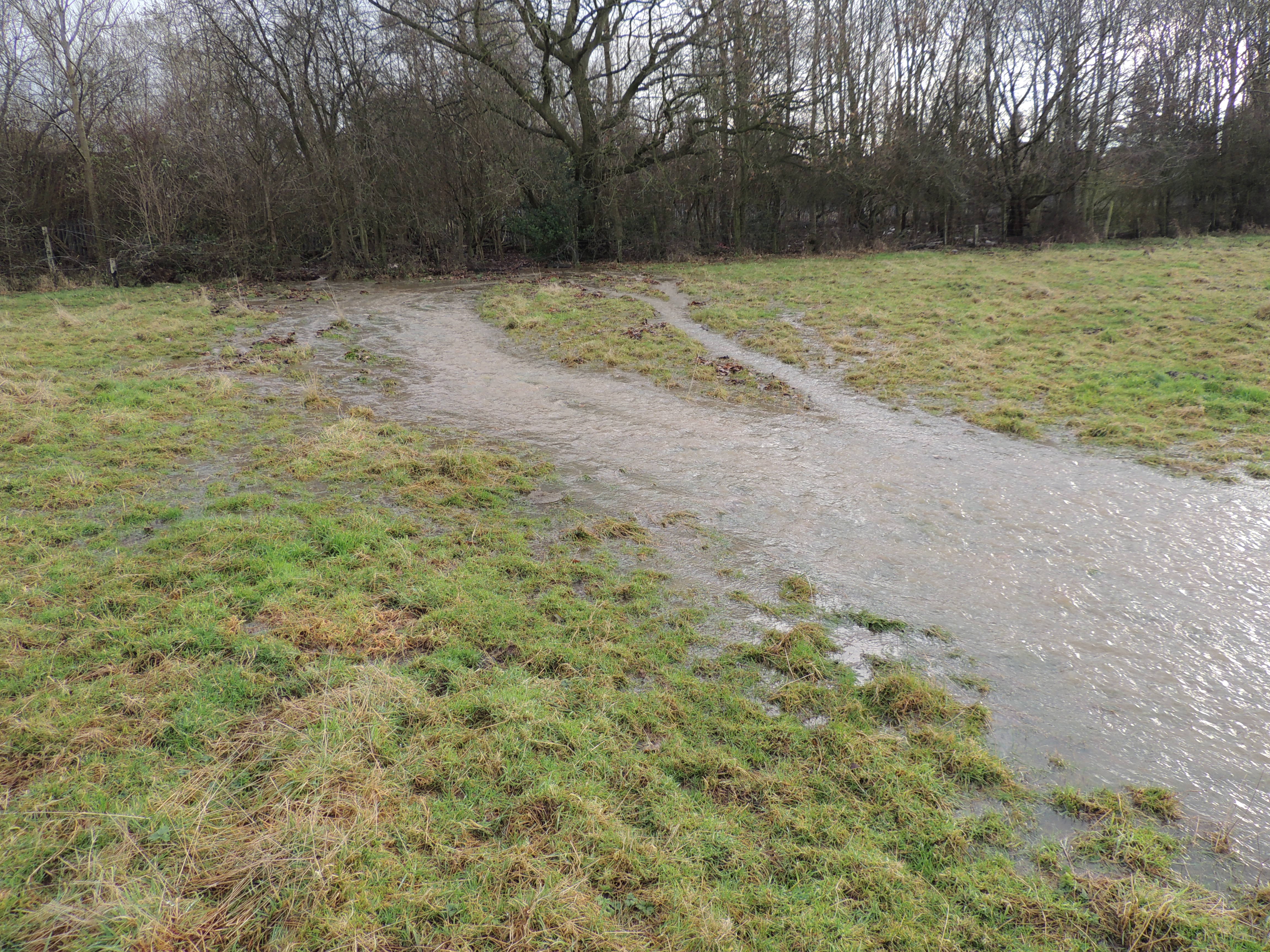
Newstead Brook rising to the top of it’s banks after moderate snow thaw.
The brook is vigorous and fast flowing in this state and would easily sweep a child away to the culvert. What happens to the water when the culvert gets blocked or overwhelmed and there is no where for it to go?
Where are the emergency pumping stations in Barratt’s plans for the development? Where will they pump the water to?
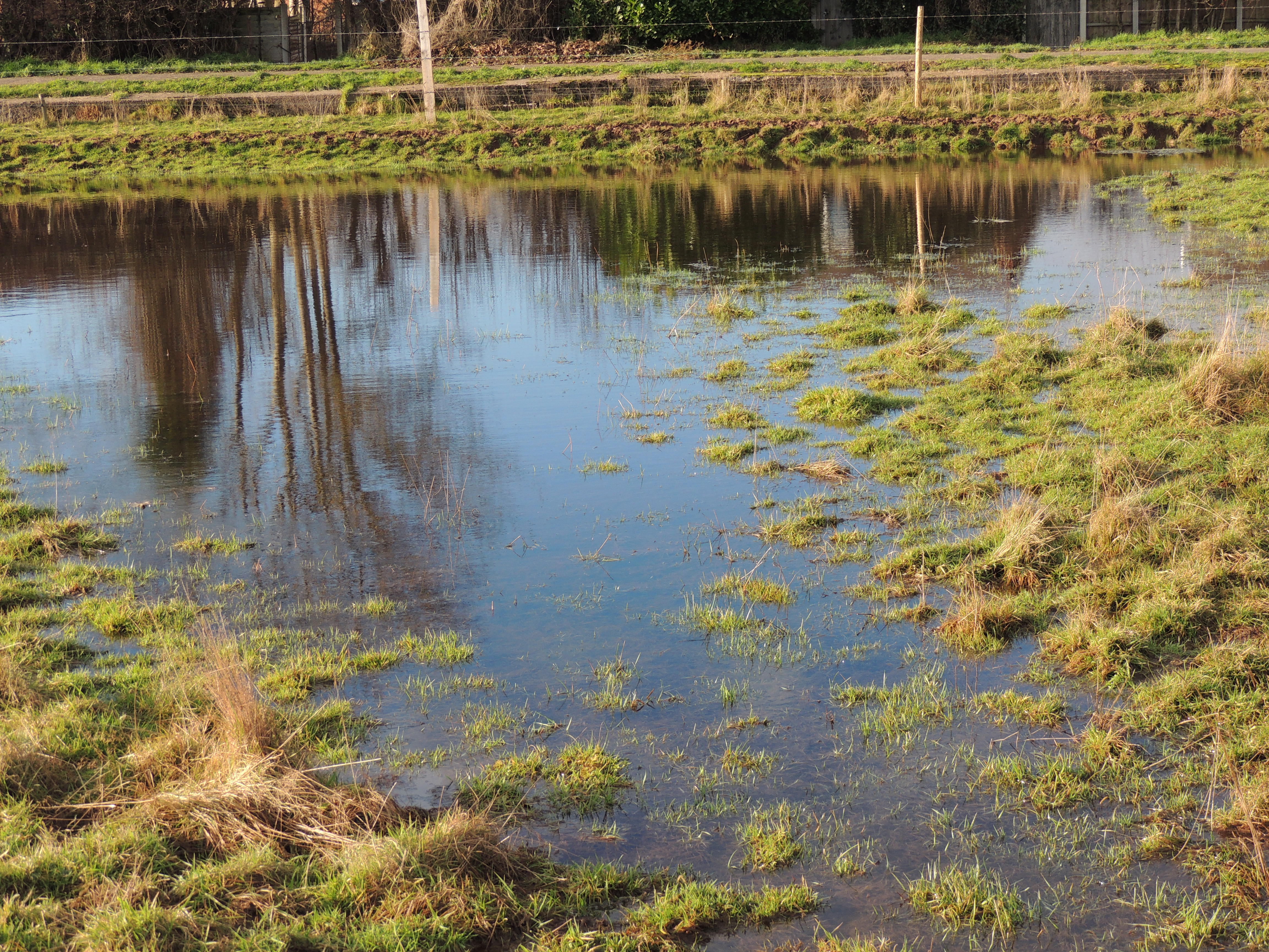
Surface water flooding and flooding entering the Meadow from the higher ground to the east.
The Meadow can not soak away existing surface water. The Environment Agency says it has to be soaked away in-situ, but where can it go on this already saturated site?


Pingback: Barratt Homes confirm they can’t be trusted! | Keep our Meadow Green